Let me just say I did not think this one would happen.
As I mentioned in my last blog post about hiking, I’ve had my eye on the Franconia Ridge for a long time. Lafayette is the queen on that ridge standing at 5,260 ft in elevation. After we had to bail on our ridge plan the other week via Falling Waters Trail, I had planned to try again at the end of last week. Had everything ready to go, Maverick in the car, tried to start it only to find out my battery was shot. Needless to say, we didn’t end up heading up to hike that day. It was like someone really didn’t want us on that ridge.
So today, I wasn’t going to bother with the ridge. Screw the ridge, I thought. I’ll get to it next year. Or something. I planned to do Pierce and Eisenhower for sunrise because it was supposed to be clear in the early morning and all day, no winds. Which is unheard of in the Whites. I had already hiked both these mountains before, but Maverick hadn’t done Eisenhower yet and Pierce owns a soft spot in my heart.
However, I snoozed my alarms that went off at 2 am…until 6:30. Yikes. So we set off at 7 from home, and I was still a zombie driving. I haven’t yet gotten back into the groove for teaching again since break, so I was running on barely any sleep from the past couple days. This resulted in me being so tired driving, I decided to just stop at the trailhead of Old Bridal Path and Falling Waters Trail. Change of plans. We were doing Lafayette.
For a nice Saturday in the mountains, it was expected that the trailhead here was pretty busy. We parked, took out a ball because I was sick of Maverick’s sticks ripping my leggings and bruising my thighs as he ran by me lately, and met some nice people we were parked next to before heading up via Old Bridal Path. PS- Maverick managed to lose his ball in the snow 0.2 miles in…..0.2!!! So much for that plan.
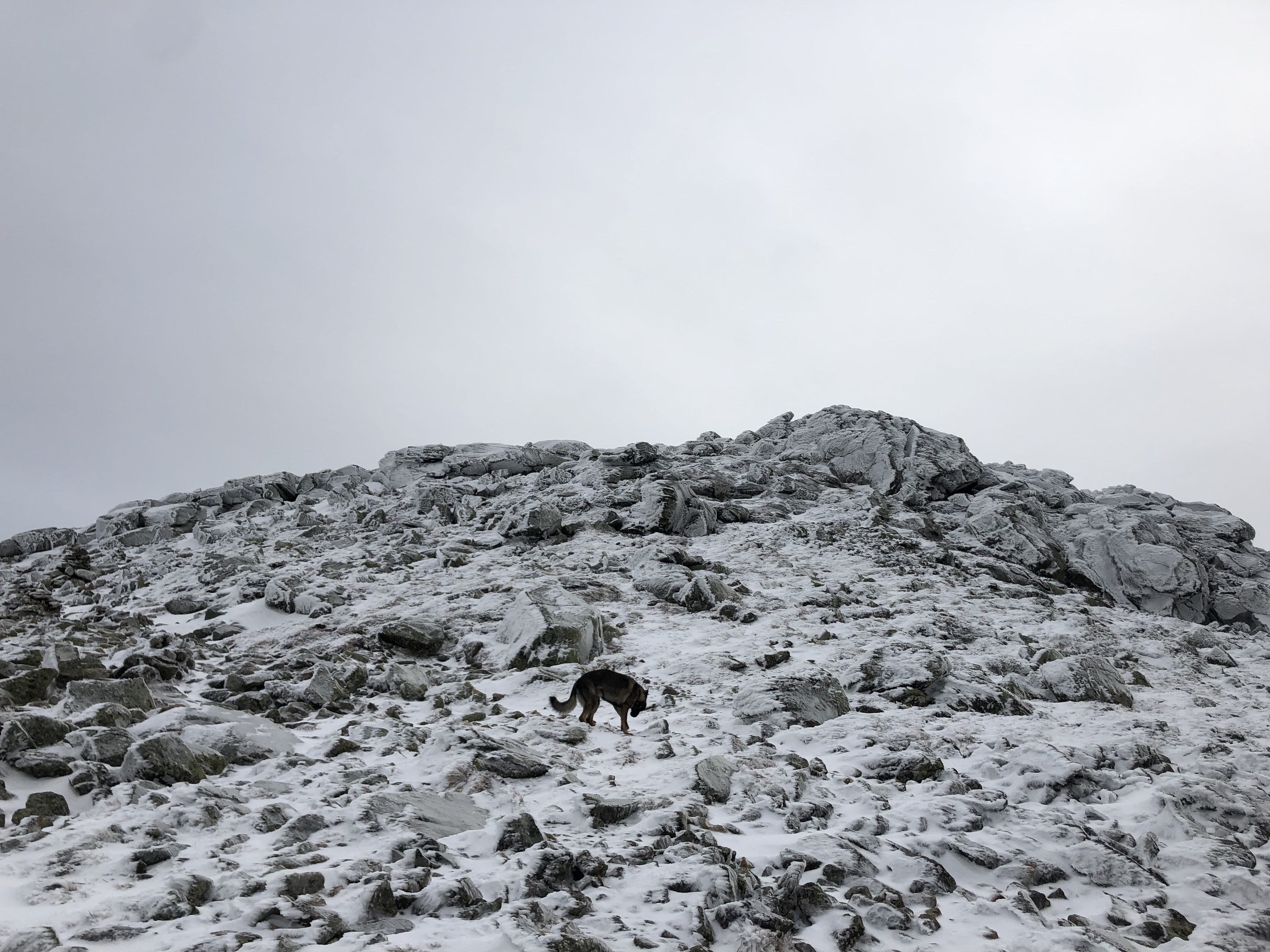
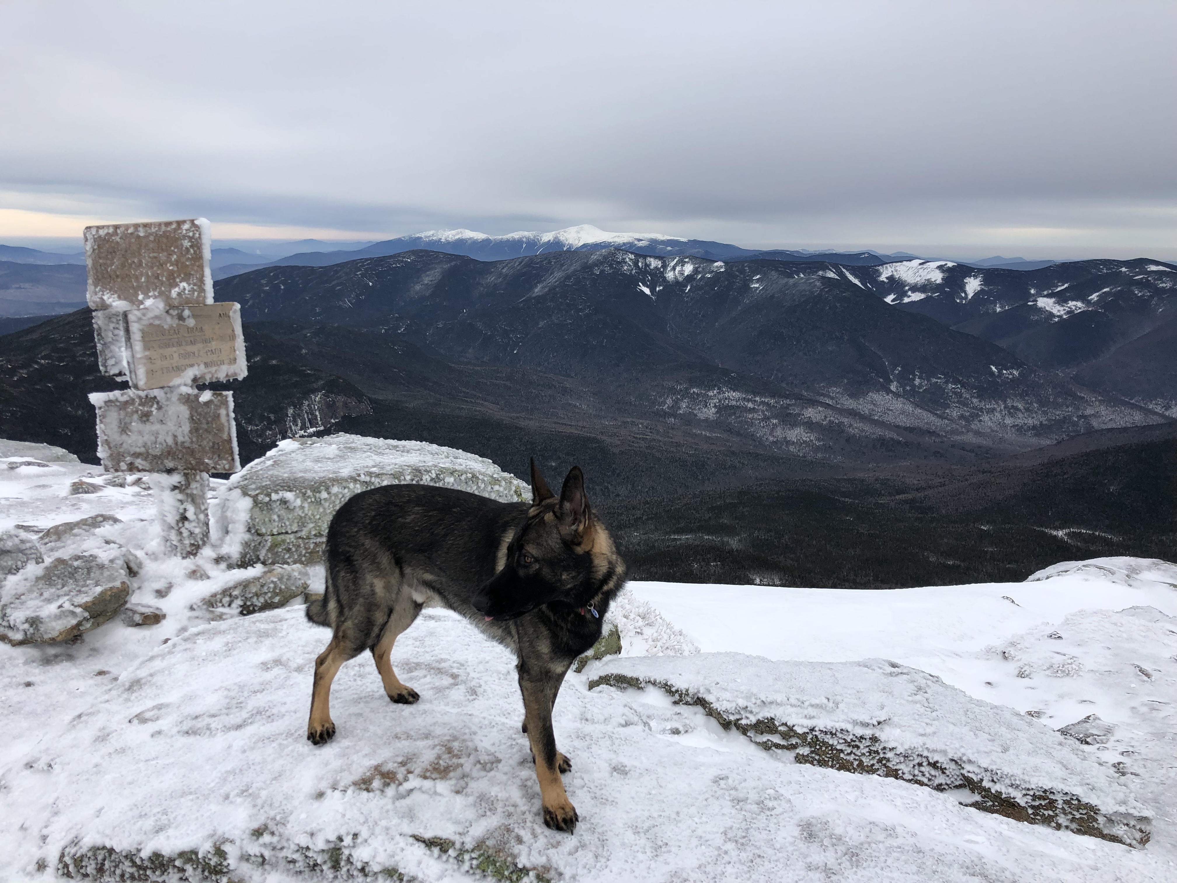
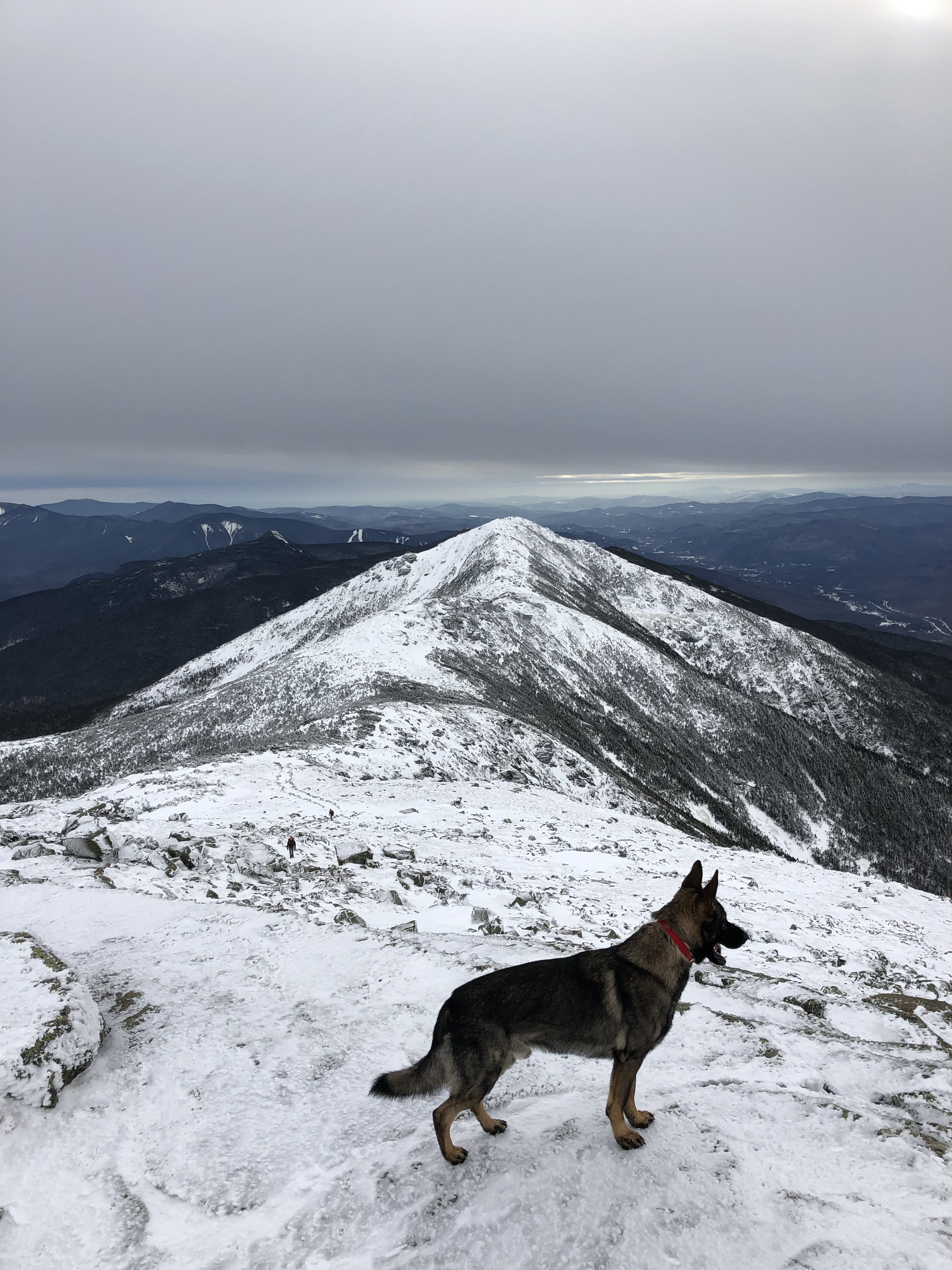
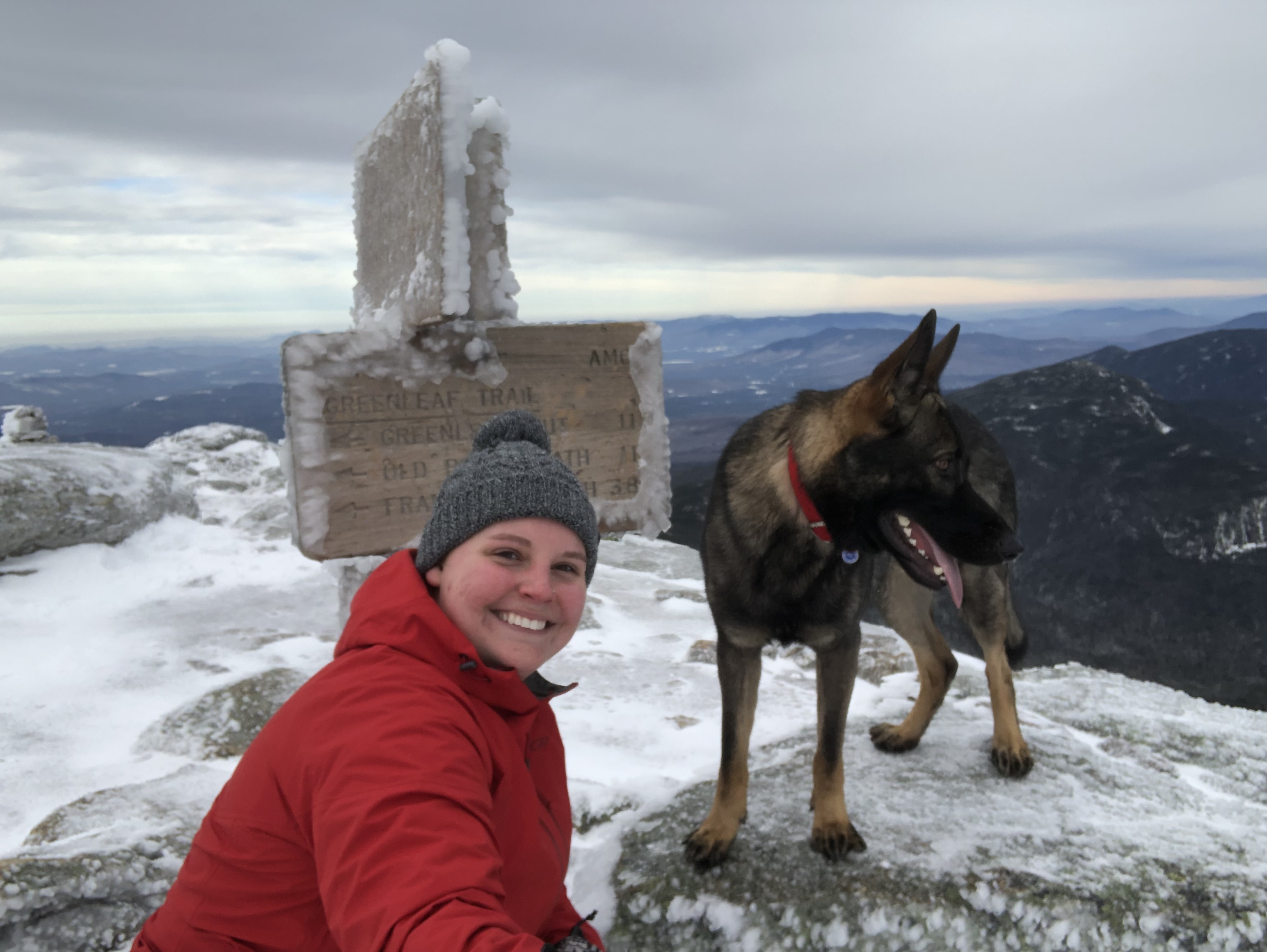
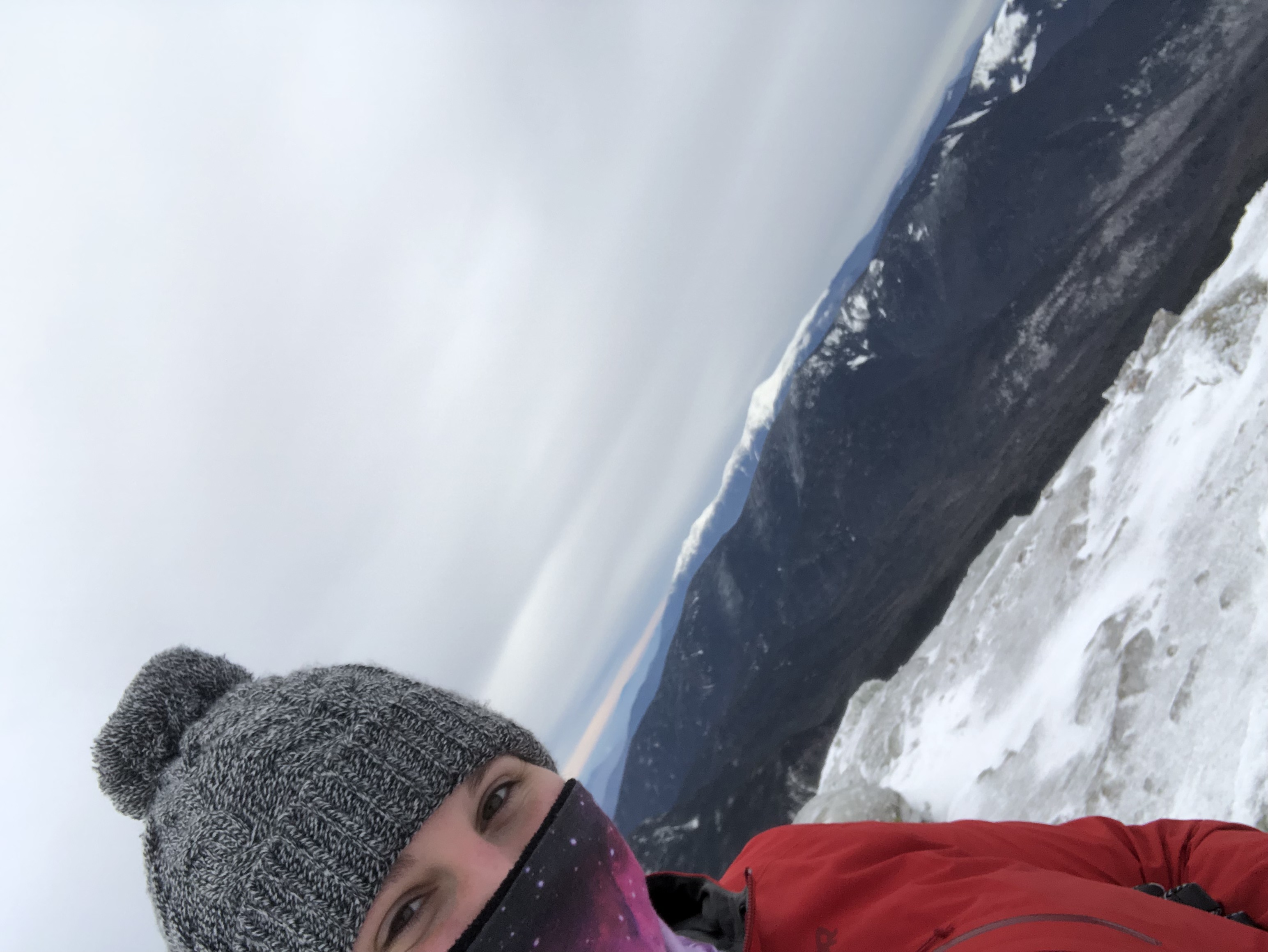
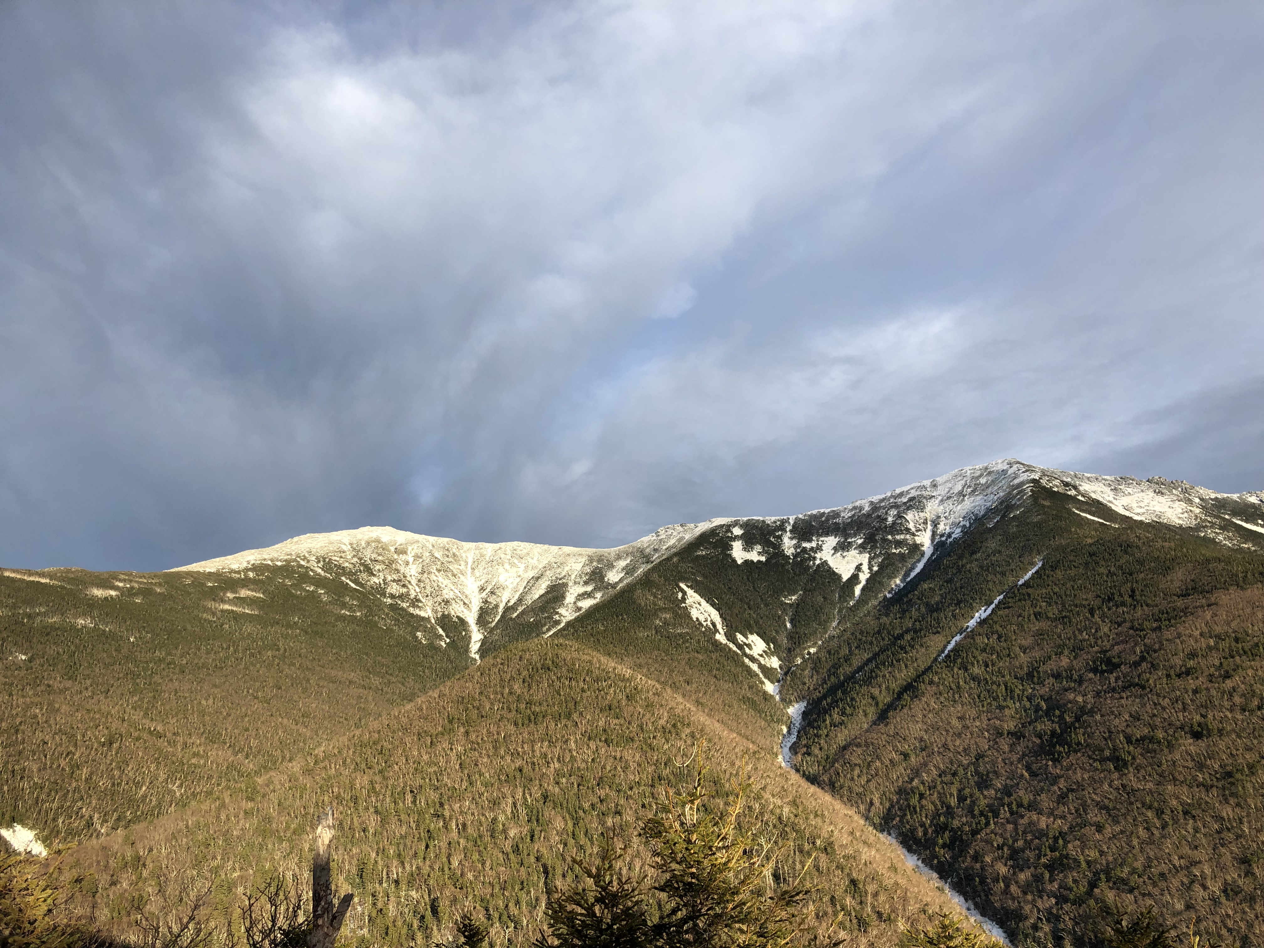
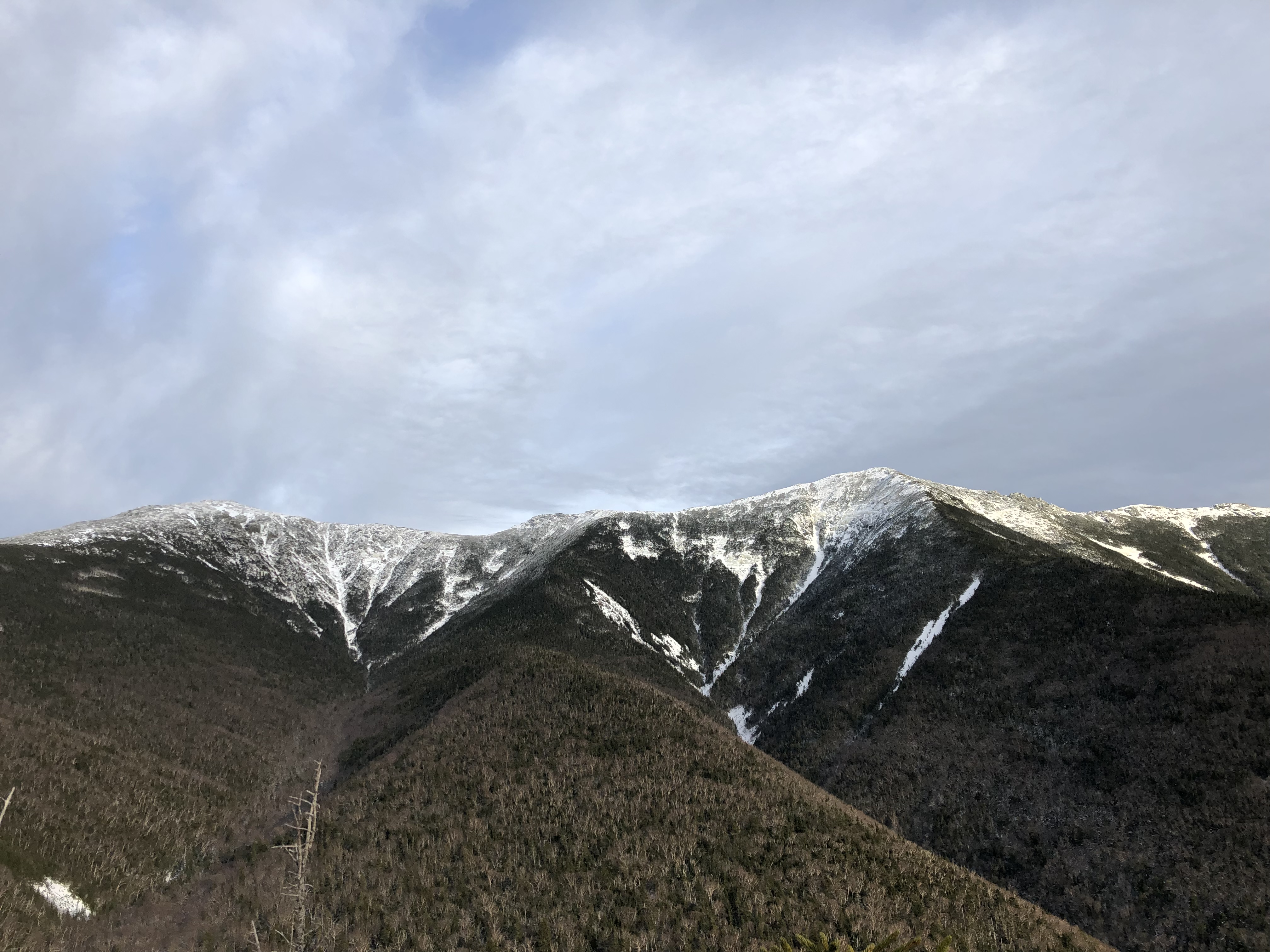
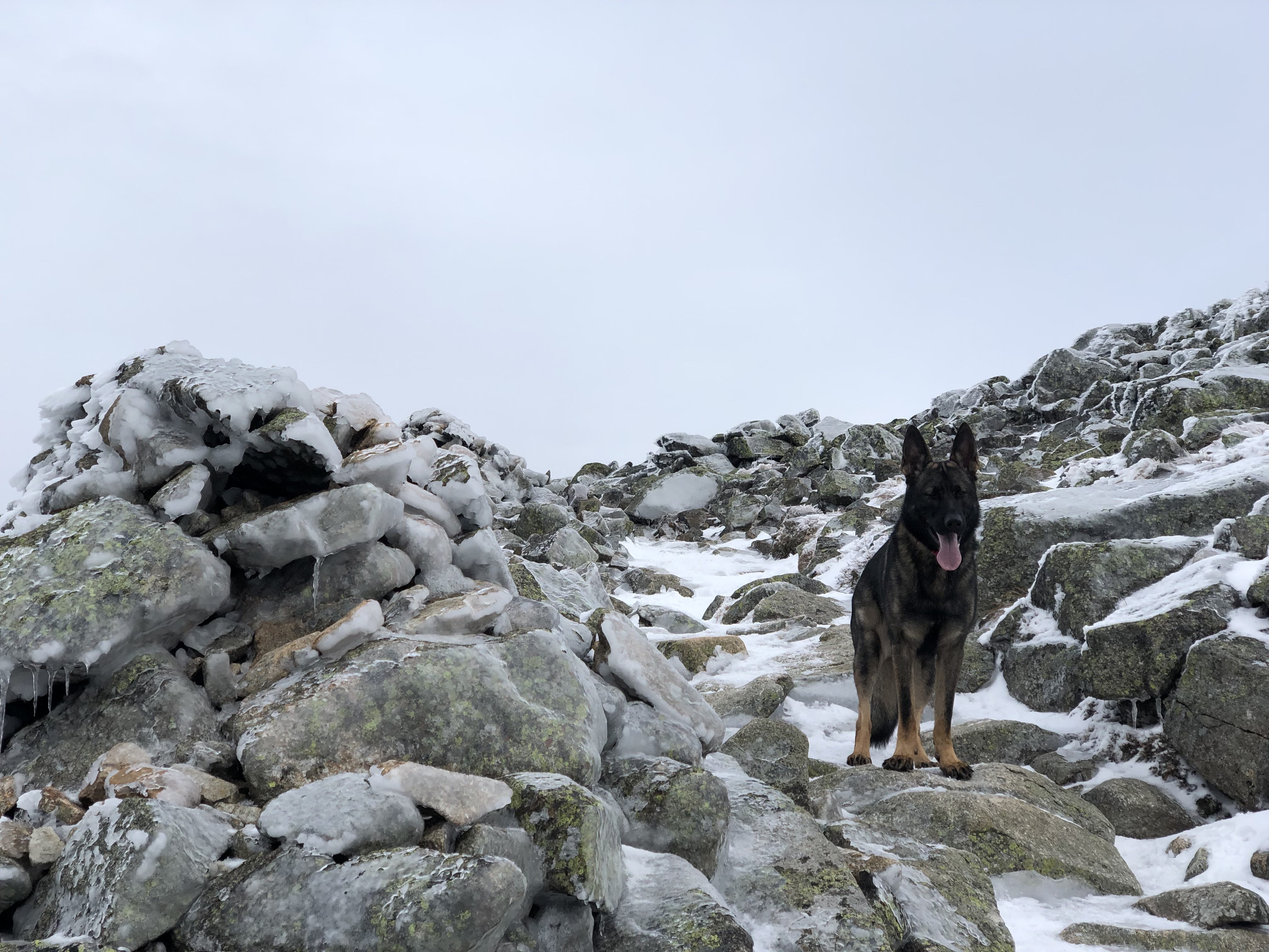
The snow was sticky enough and packed in enough to not even need my microspikes on and the climb was pretty steady for the first mile and a half. Then some steep parts started to intersperse once we got our first peek at Lincoln in the distance. I had known that from 1.9 miles to 2.9 miles the trail was known as “Agony Ridge”, a name that originates from the hut cru of Greenleaf Hut who have to haul giant packs of supplies up for the AMC hut. Let me tell you, this ridge lives up to it’s name. It’s a killer for sure, but it also has the most amazing views. 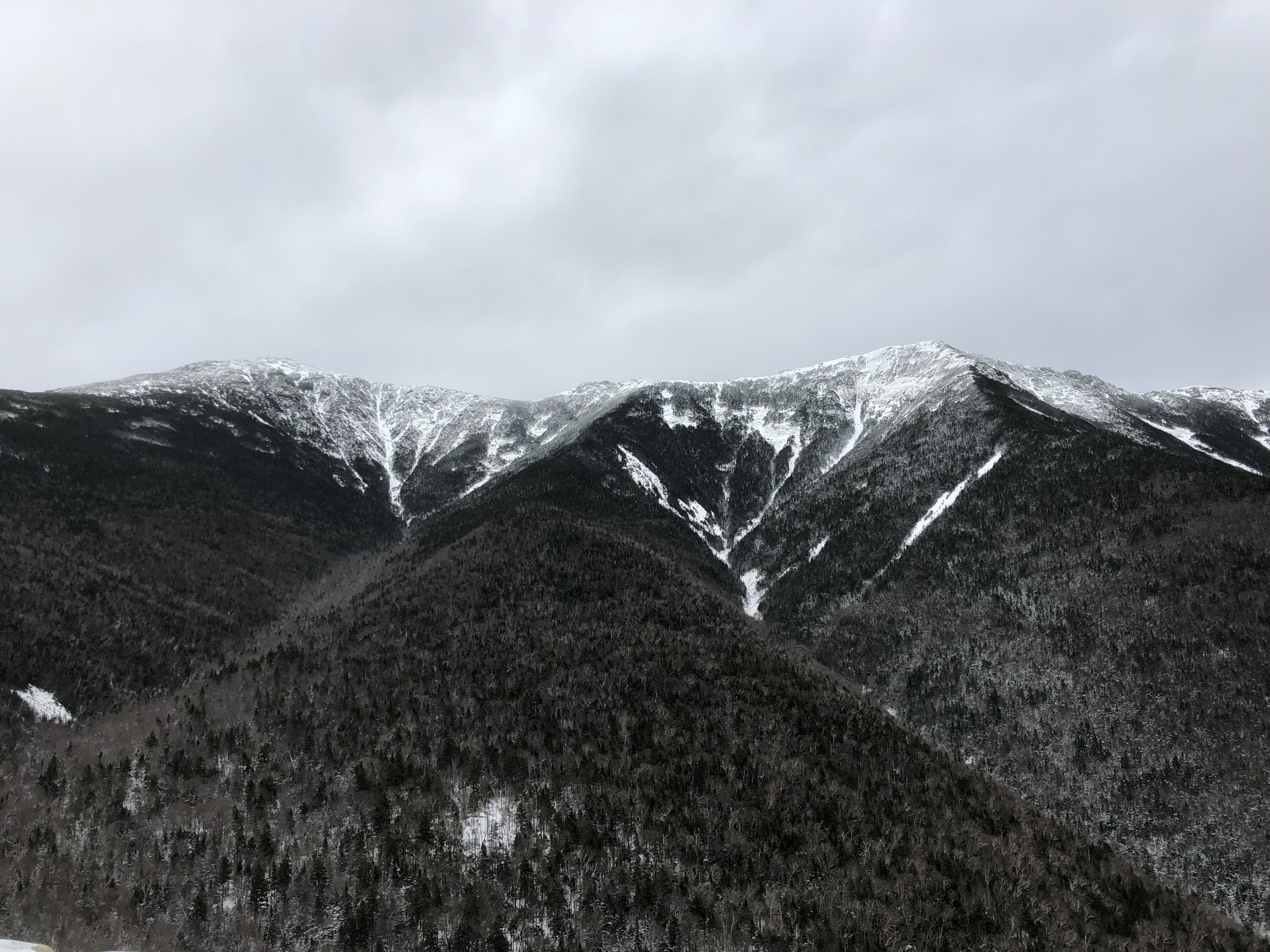
These outlooks are also where we encountered our first people of the day. I think most had chosen to ascend Falling Waters Trail…which I was avoiding at all costs…and then do the ridge to descend via Old Bridal Path, so we got to enjoy our hike up virtually alone. At one outlook, we ran into a group of 3 girls and 2 dogs who Maverick was all excited to try to play with before we went on. The trail got steeper and I finally put on my microspikes, though it was so warm with zero wind that all I had on was a long sleeve shirt and underarmour and was still sweating.
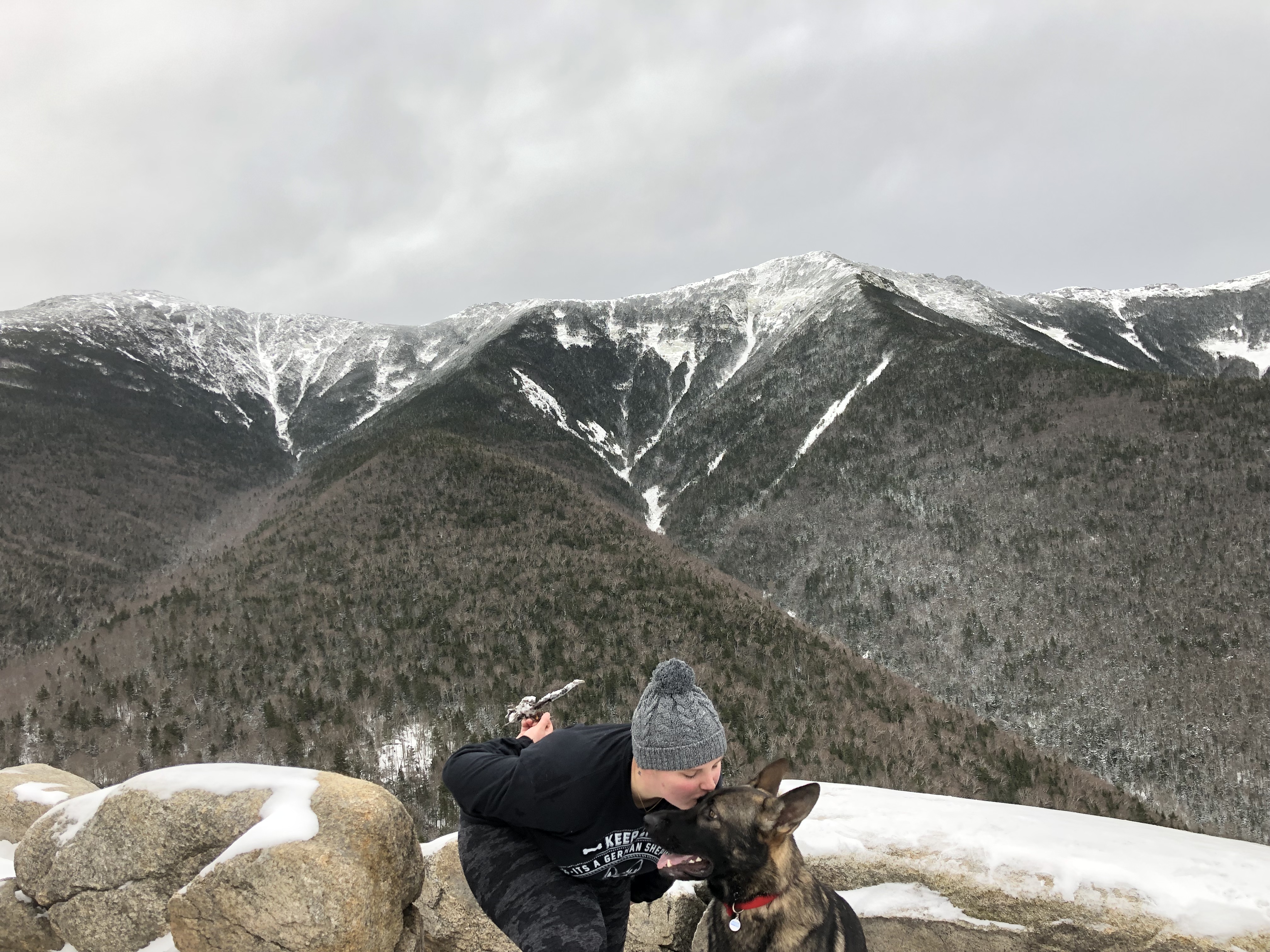
At Greenleaf Hut, we took a much needed break to eat a clifbar and put on some Musher’s Secret, which Maverick acted as if I was amputating his foot each time I swiped some wax on him. Shepherds, man. The girls and dogs we had encountered before ran into us here again, so I offered my Musher’s Secret to them as well before we started up the last 1.1 mile to Lafayette’s summit.
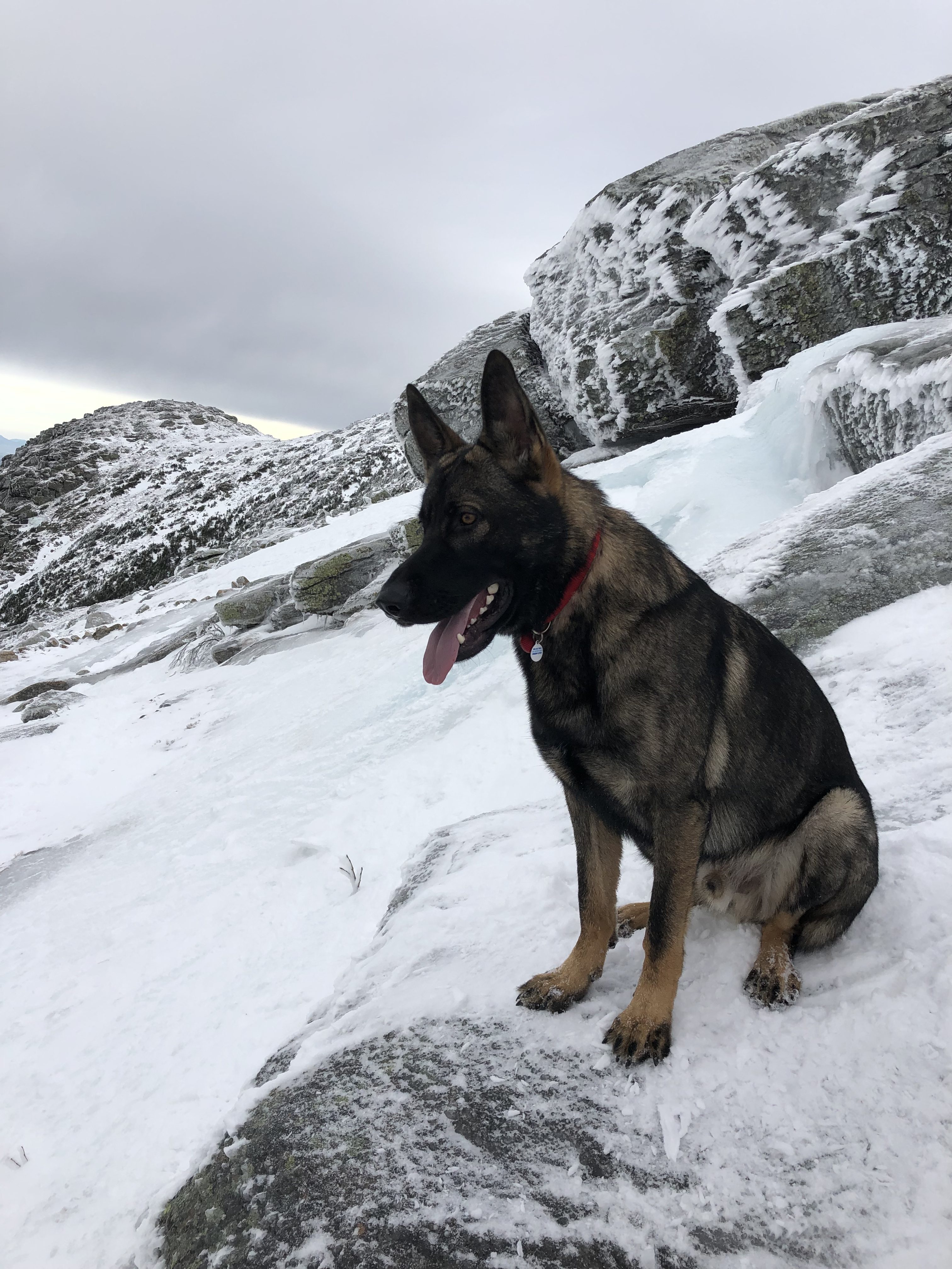
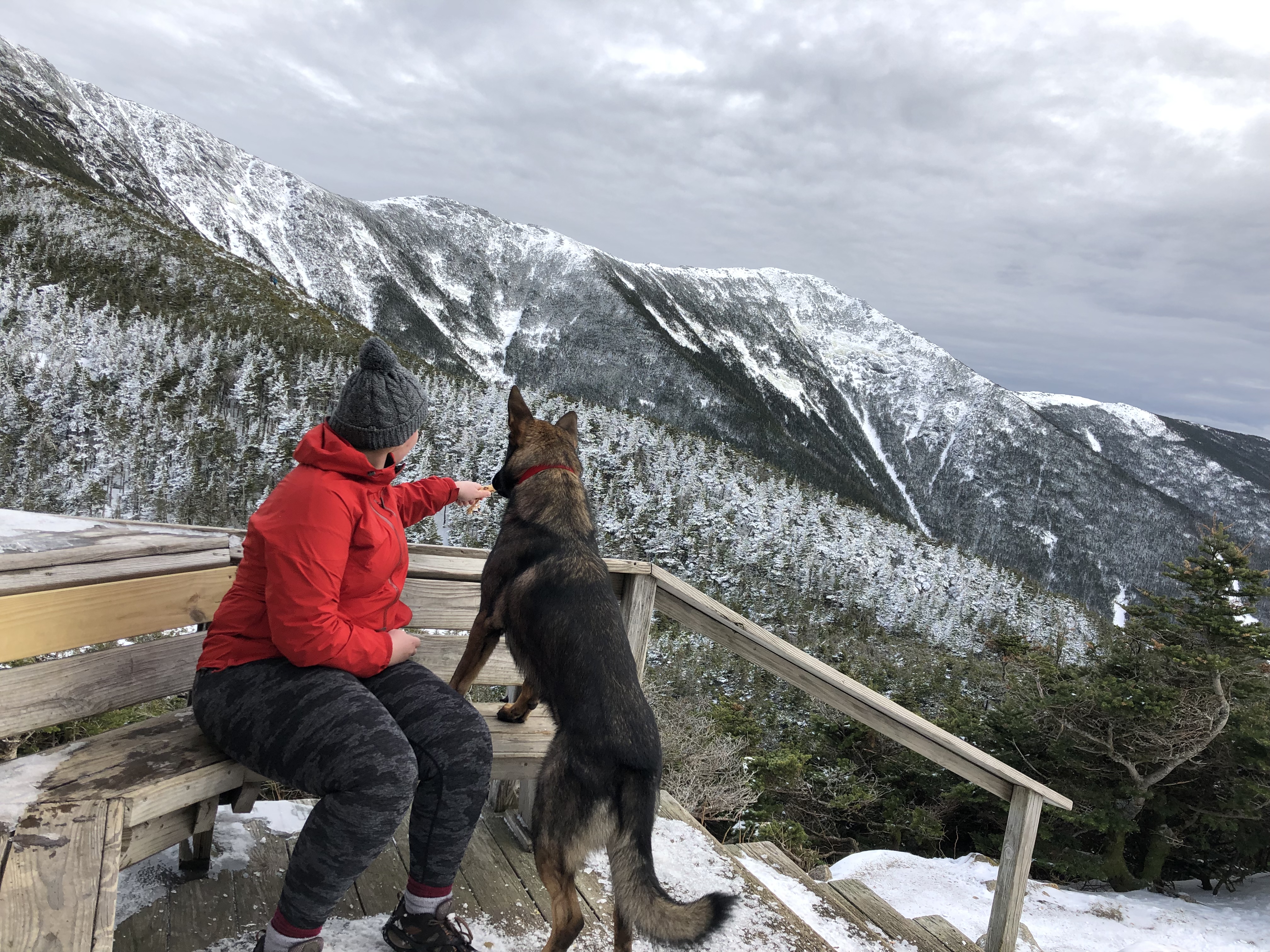
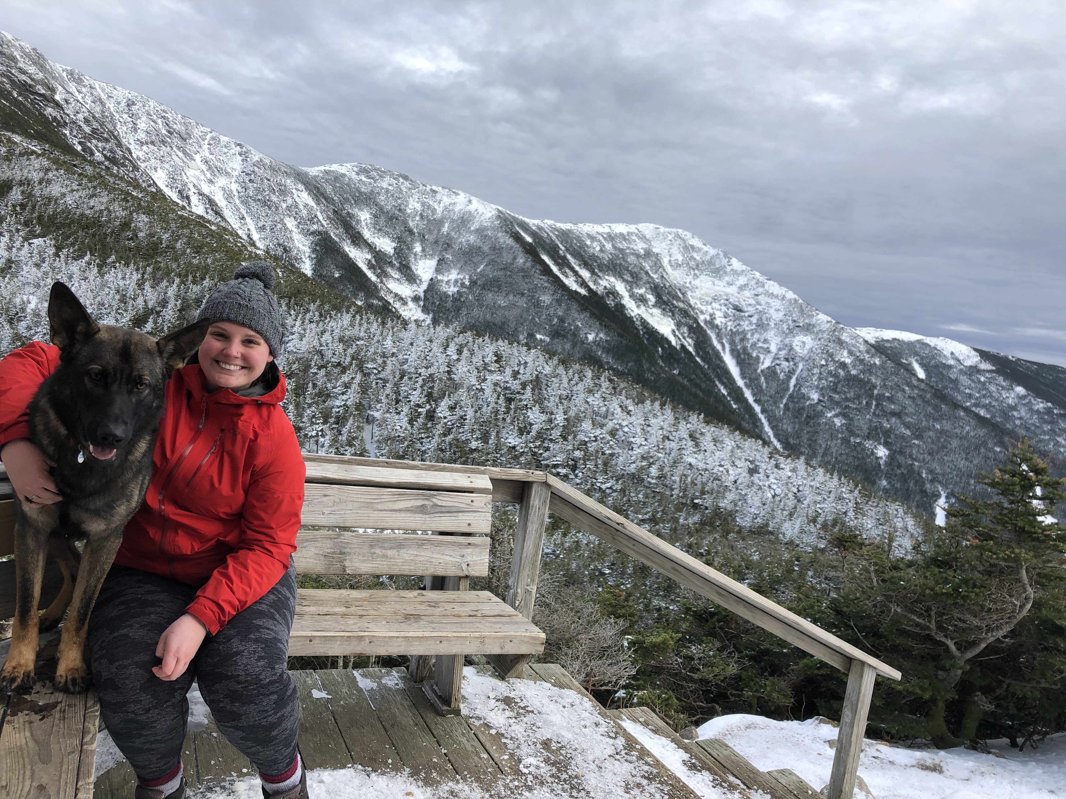
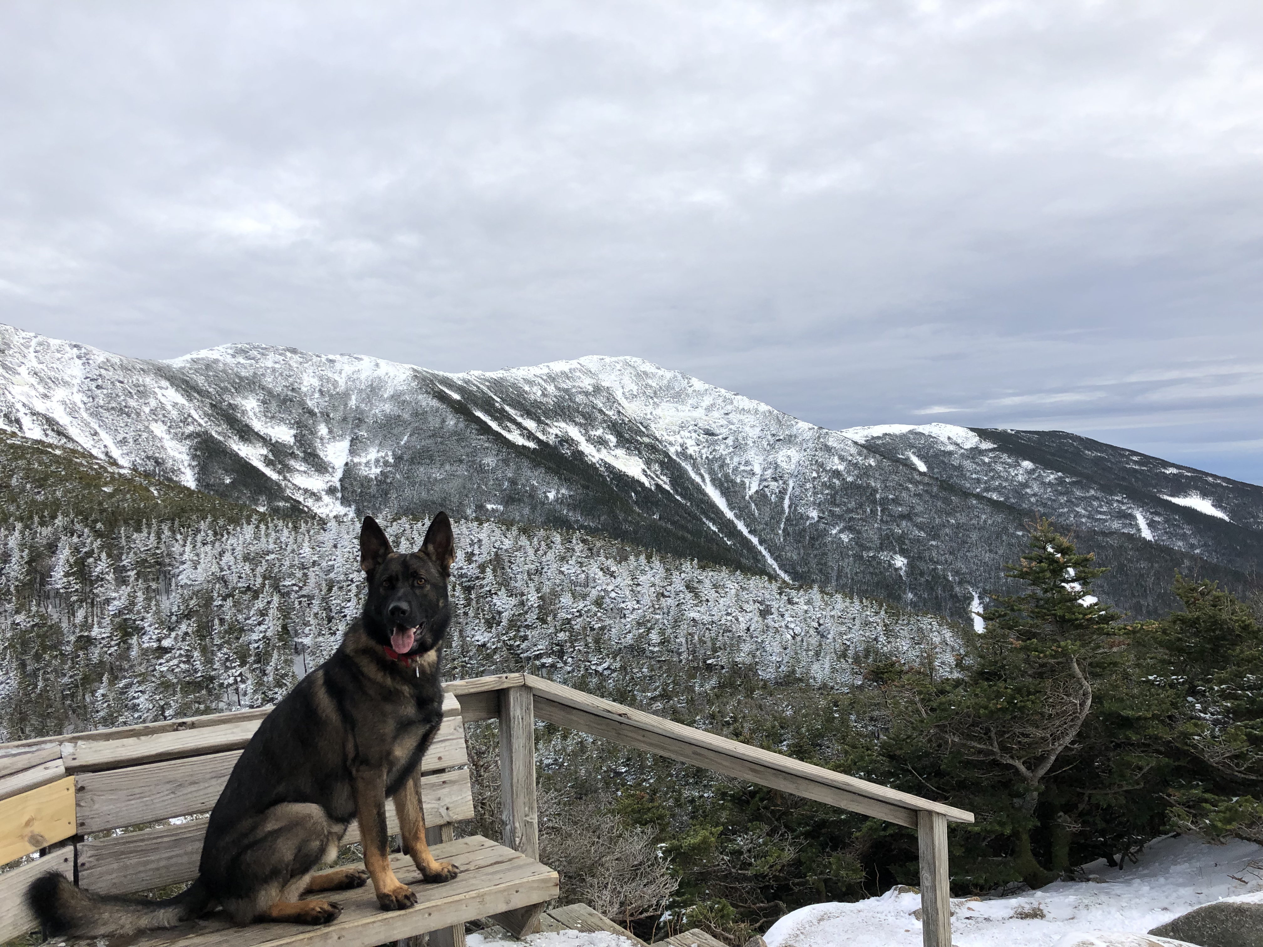
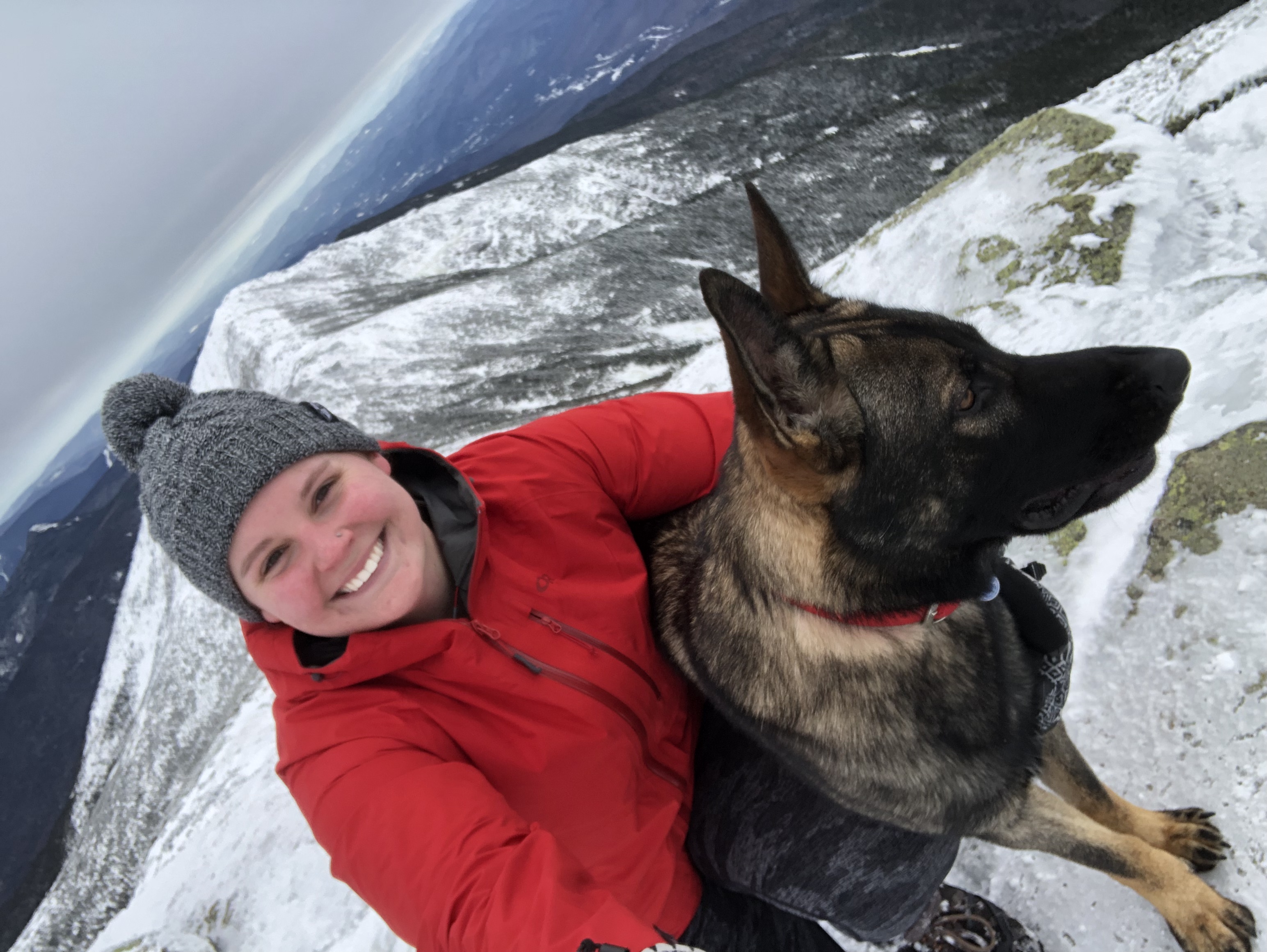
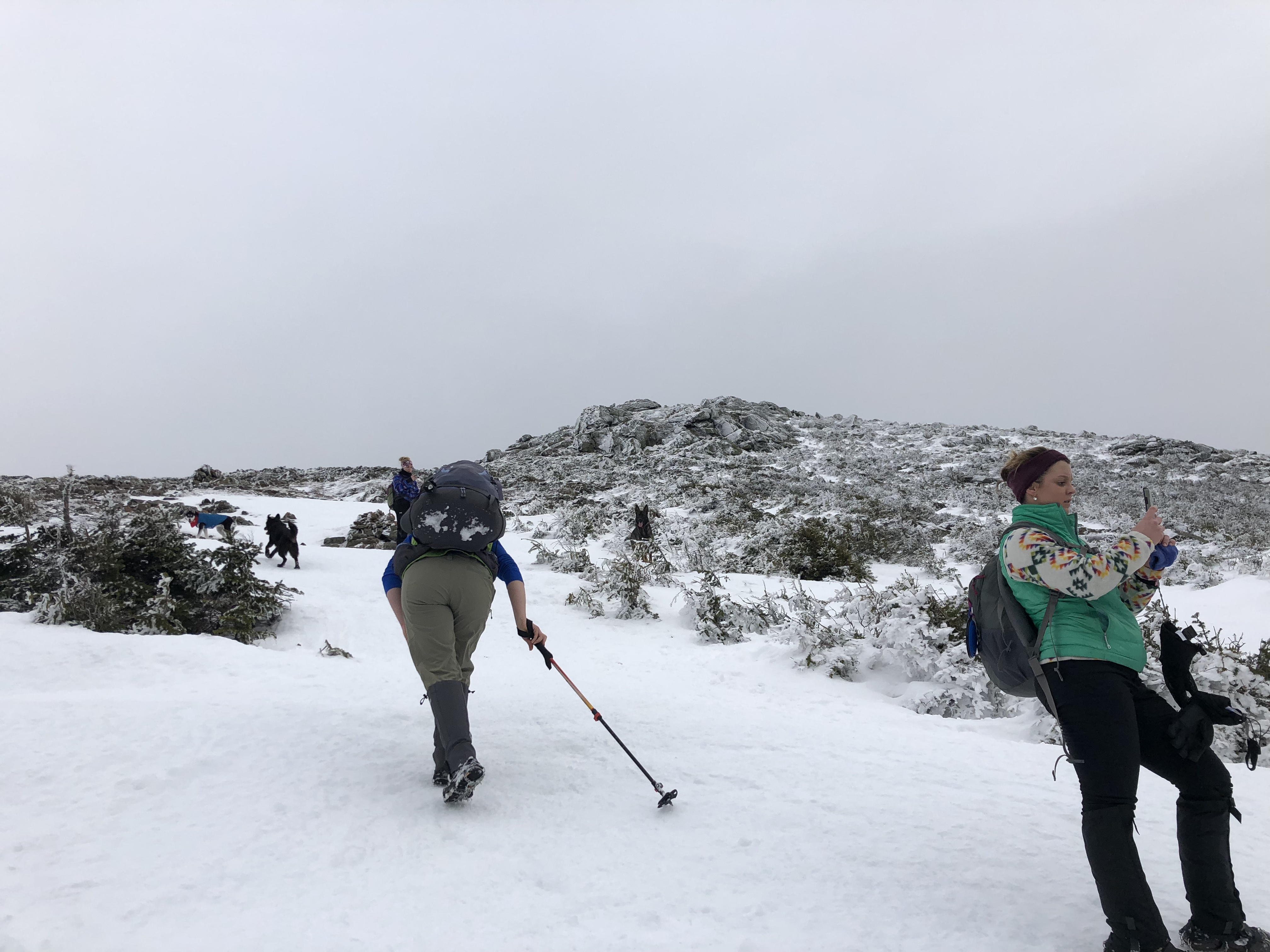
Upon entering the alpine zone, everything changed. The girls and dogs caught up to us again and we ended up hiking together for most of the rest of the way up, which was really nice. Maverick loved the husky, Teeko, and his owner and I even ended up exchanging numbers to hike together again sometime because she tries to get out every weekend as well. They were a fun group which made it so that even when my microspikes failed me at one point and I slid about 20 yards down the mountain again, we were all able to laugh about it. I guess that’s the perks of not hiking along.
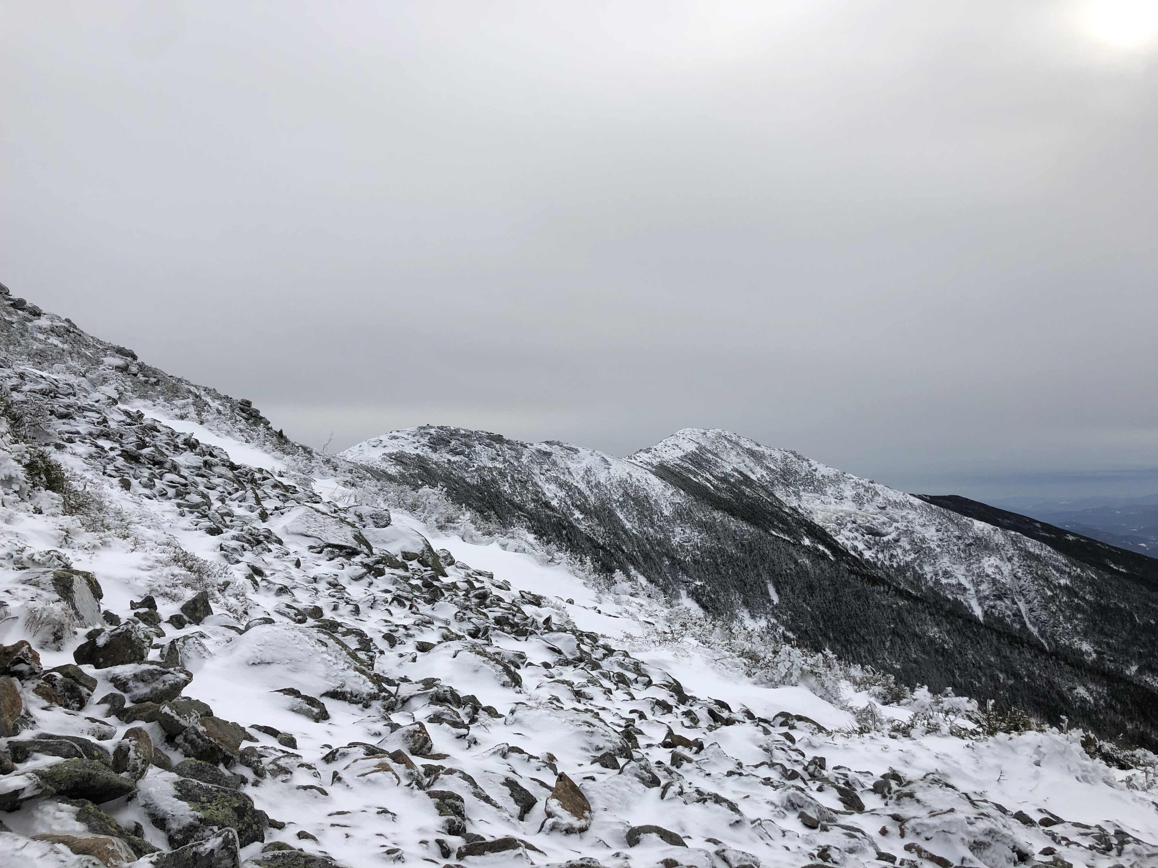
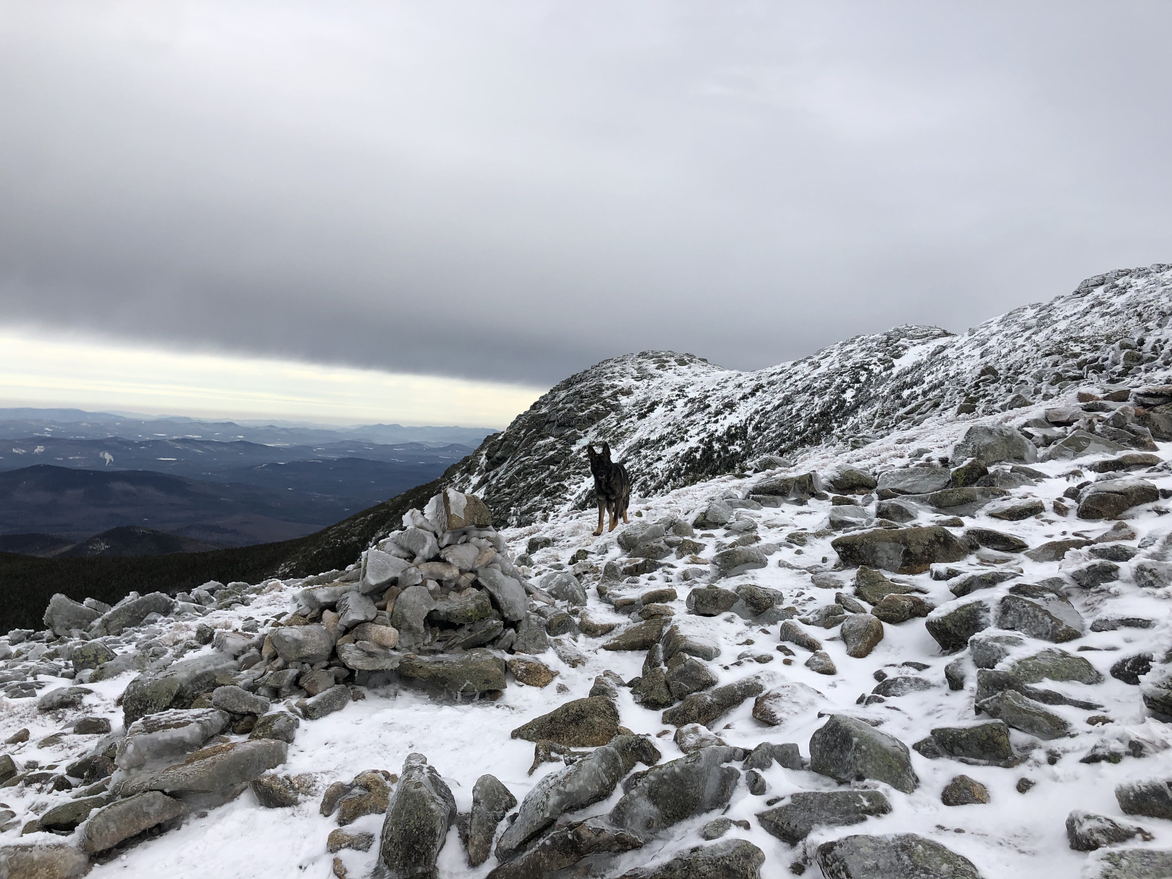
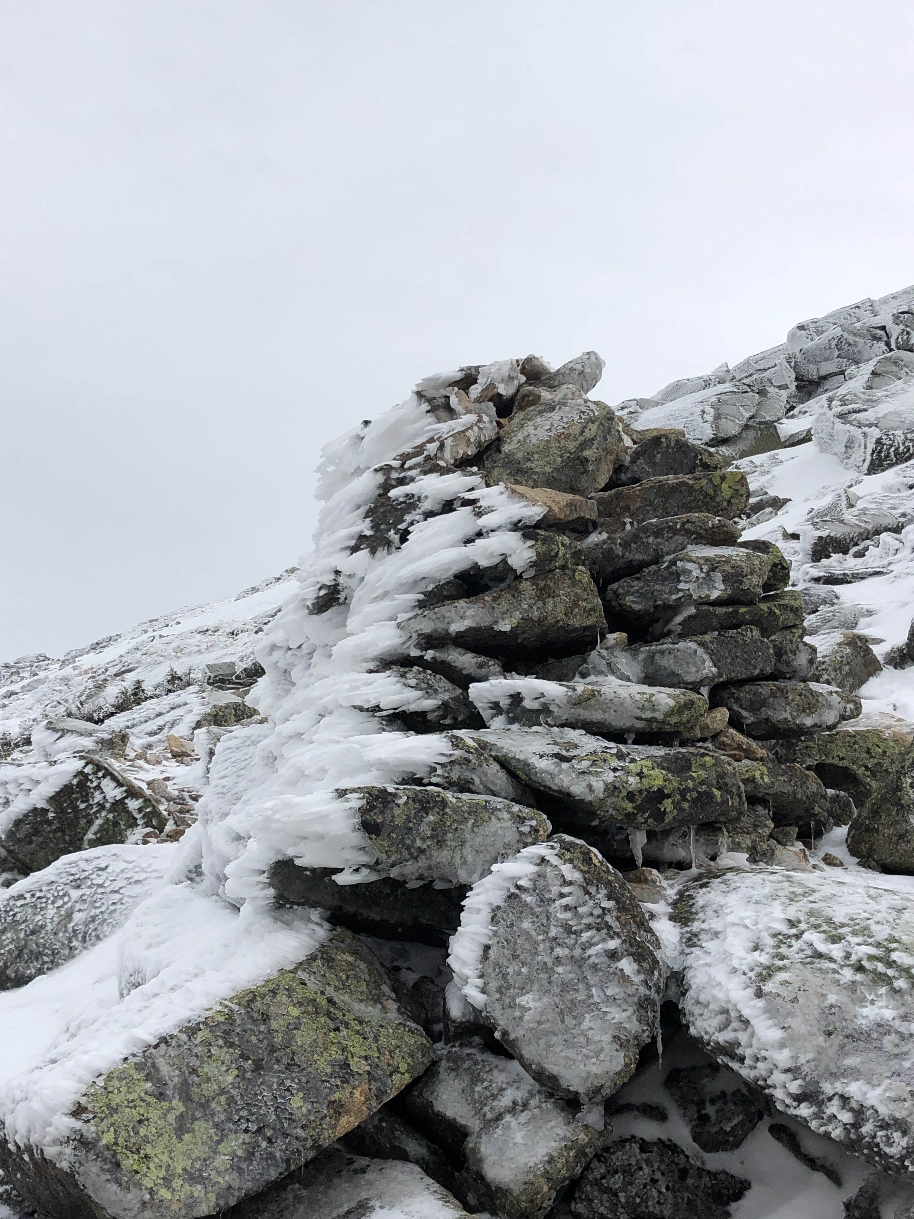
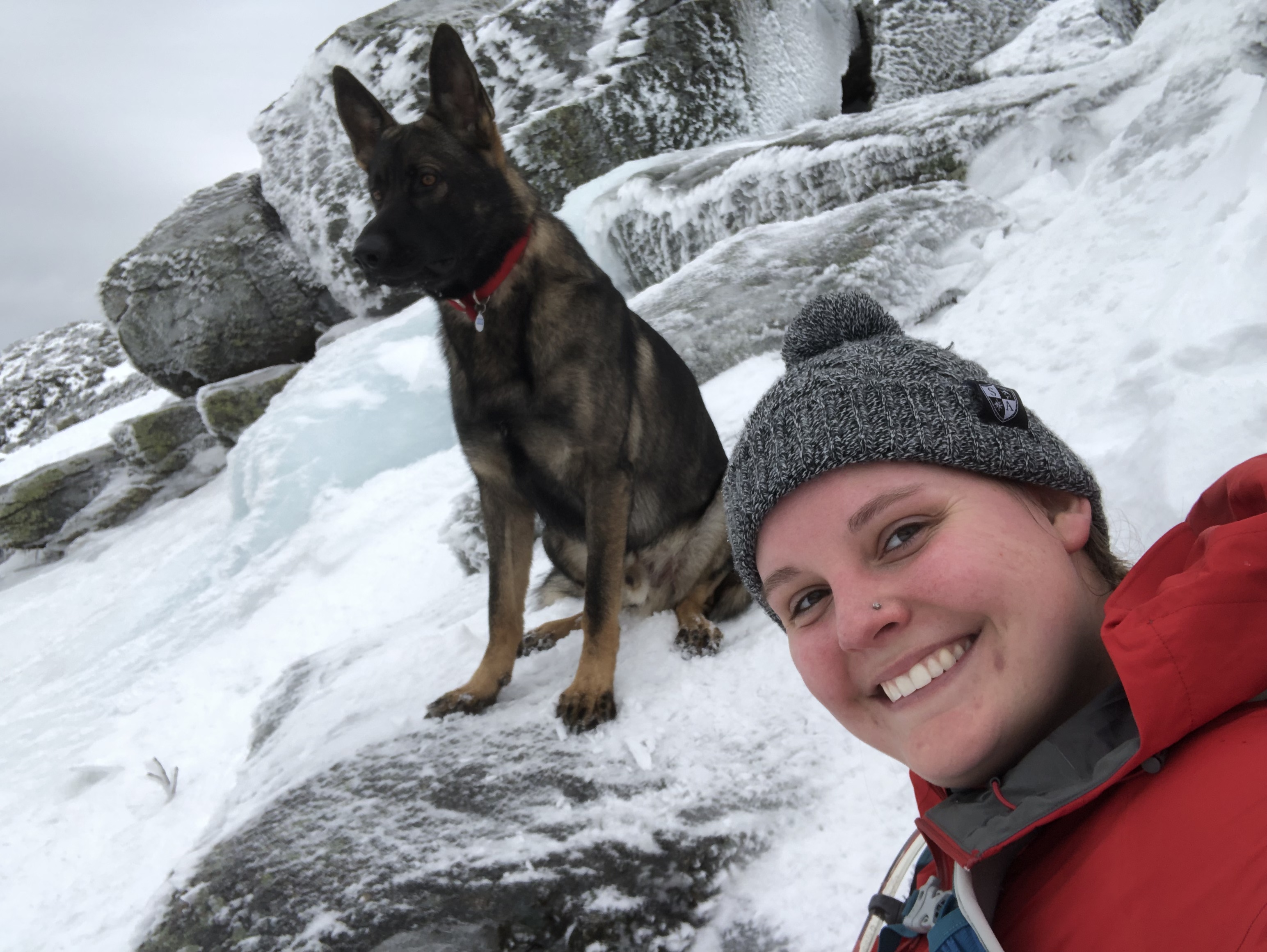
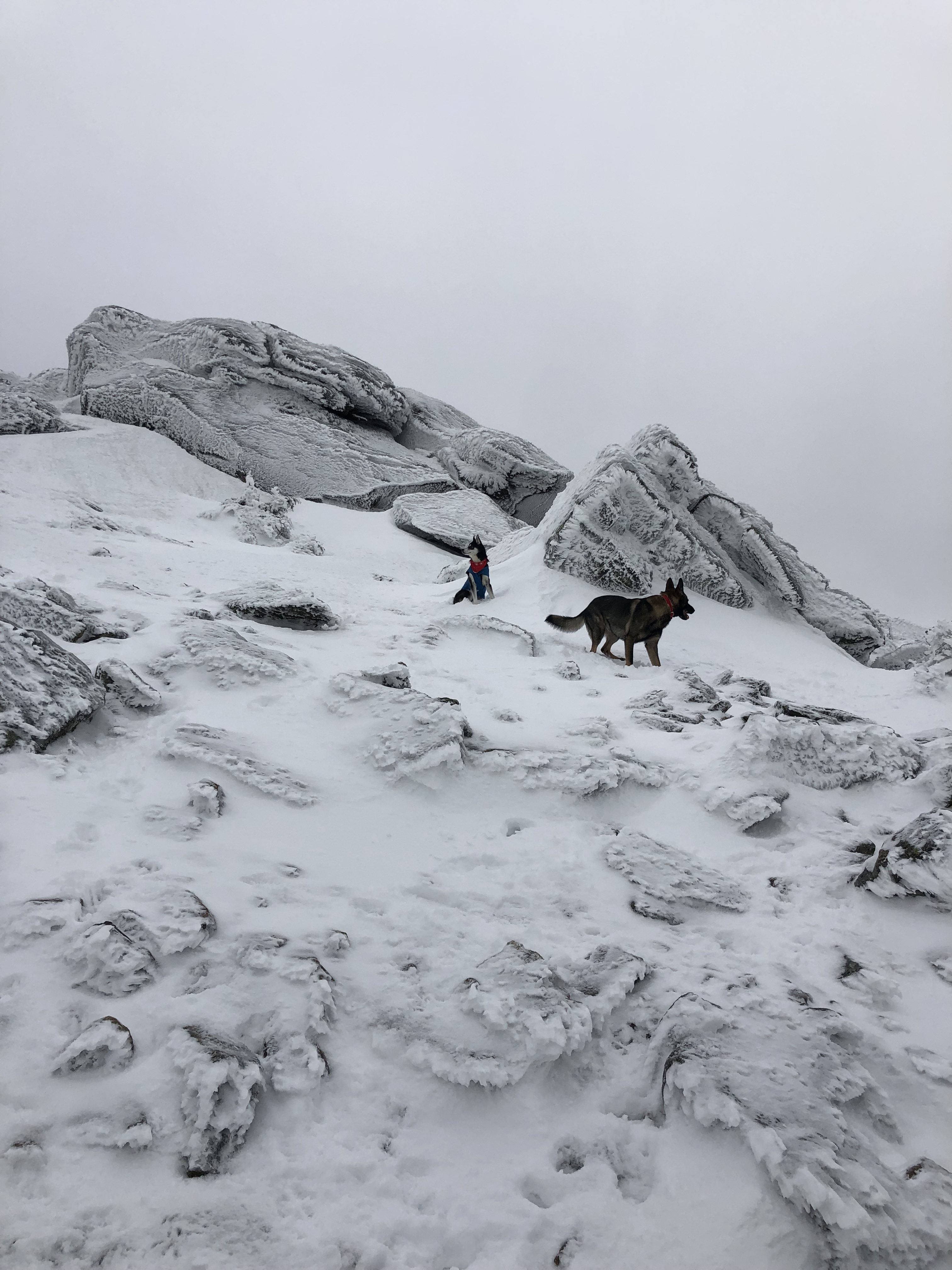
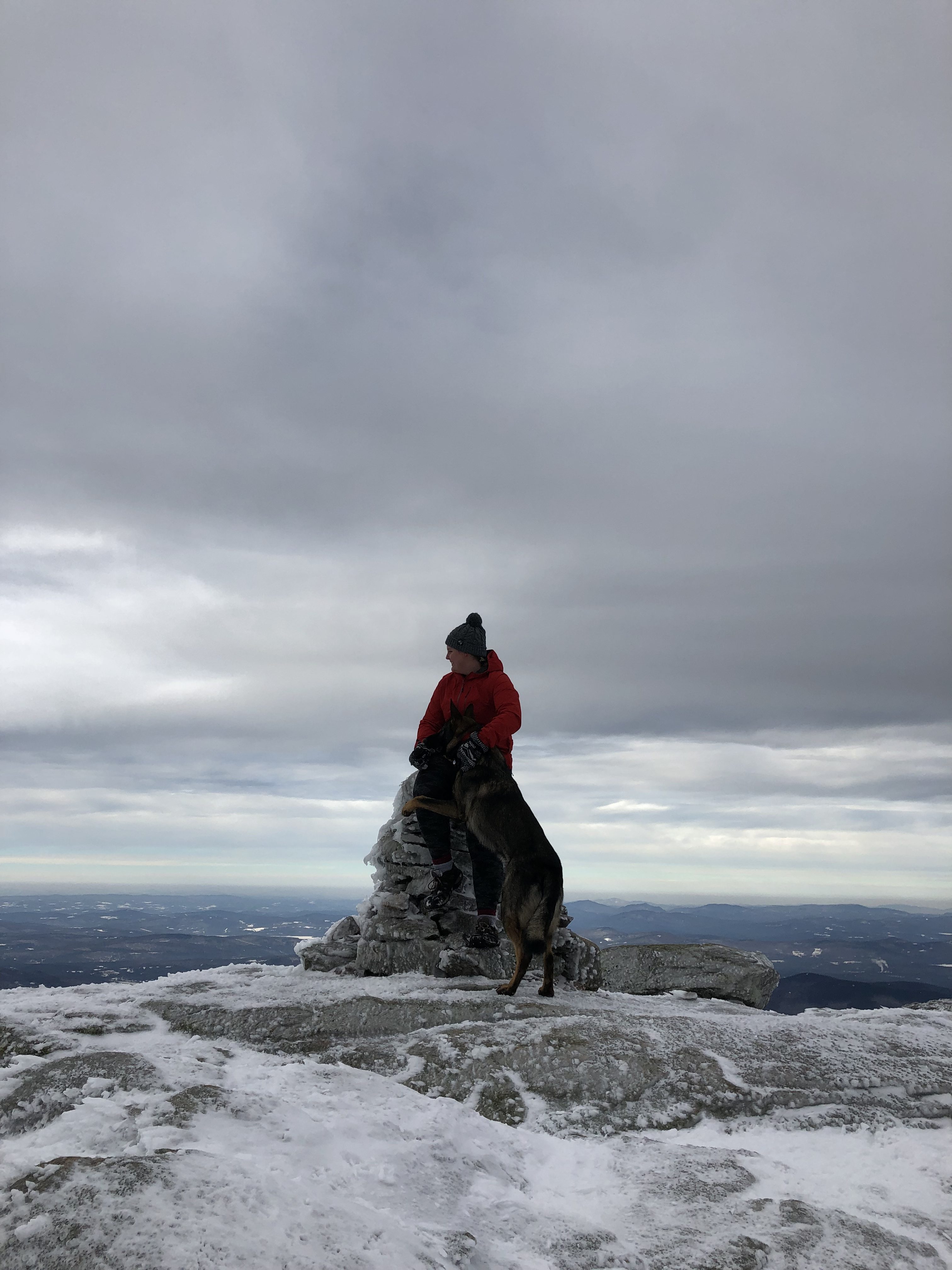
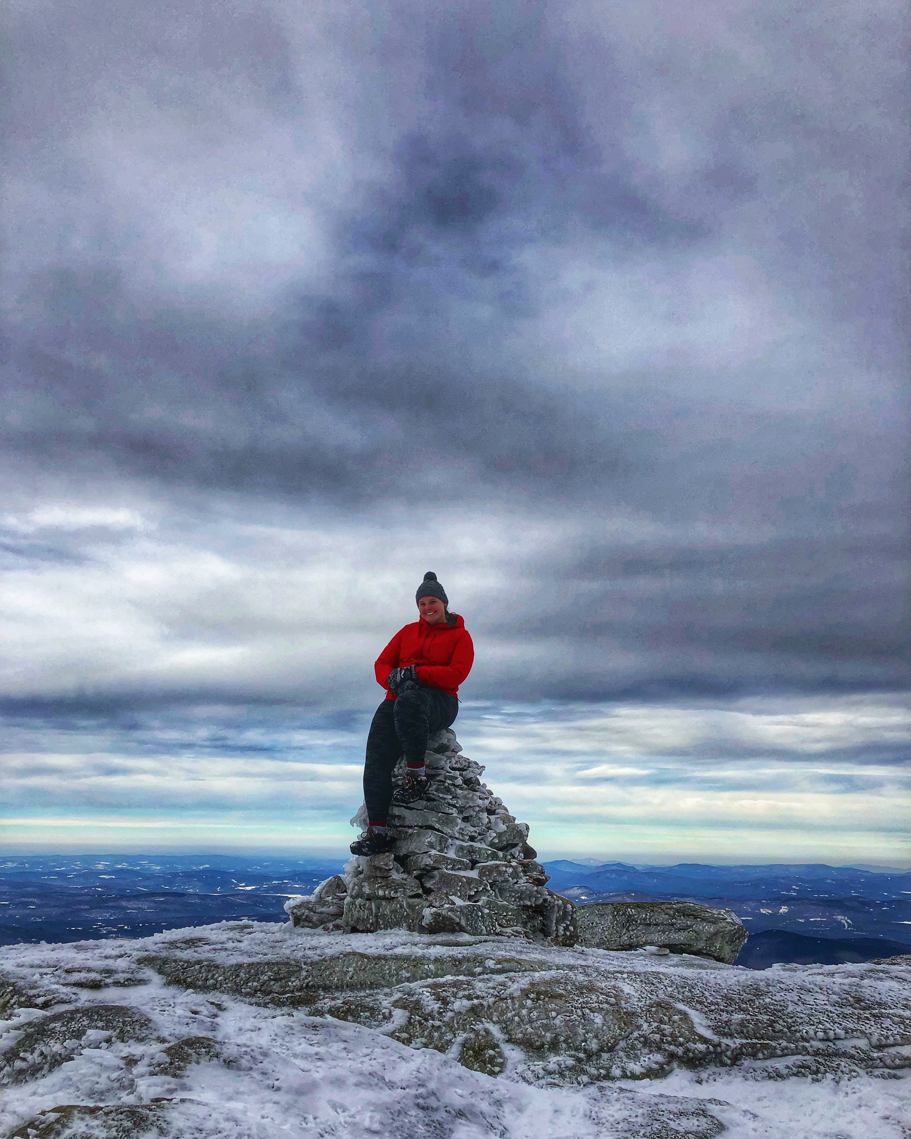
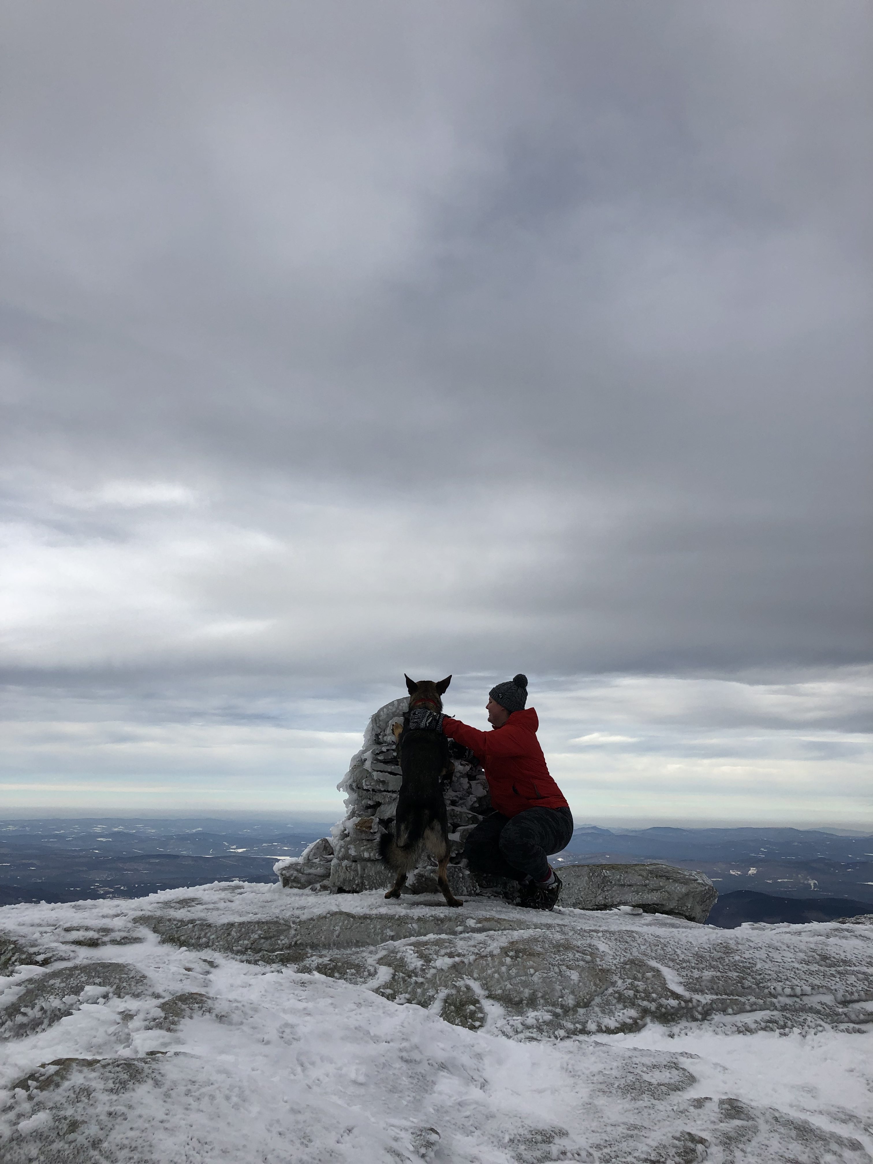
At one point, so close to summit, we got to what I referred to as the boulder problem (thanks Alex Honnald for that term 😉) the trail originally went through these two huge boulders (pictured below) but that had become a waterfall of blue ice. Very pretty, but also pretty impossible to ascend. We tried to look at alternate ways up, but the prospect didn’t look too hot. I was thinking I might have to call it and yet again not reach summit. But then my 3 new friends caught up to us, and myself and two of them tried a way up to the right of the boulder problem. They were able to make it up, but yet again my microspikes failed me. (Yes I’m aware I really need to invest in some good crampons. Trust me, I know) I had to turn around, this time sure I wouldn’t make it and had almost resigned myself to this fact. But then a group was coming down from far off to the left and waited until I was back on trail to know I had made it safe because they thought I was crazy for being alone. The thing is here, everything is ice. Every single step you take is calculated. You have to watch where you put your every footstep. Feel how you dig in to make sure you won’t slip. Squat and bend and stay low so that should your foot slip out, you’re ready to catch yourself. It’s the most technical hiking I’ve ever done. It’s hard. It’s an adrenaline rush.
This group advised I try how they had just come down, far to the left of the boulder problem. If I swung far enough left, low in the rocks, and then ascend in their tracks, I should be able to make it. Part of me wanted to say screw it. I was exhausted. We were close enough. But giving up is not in my nature. So I thanked them for their concern in my coming back down to the trail from our failed attempts and the advice on where to try next and off we went.